• Skip to main content
ct male logo v2

C.T. Male Associates

  • WHO WE ARE
    • History
    • Management Team
    • Locations
    • Affiliations
    • MWBE & SDVOB Partnering
    • Community Engagement
  • WHAT WE DO
    • ENGINEERING
      • Civil Engineering
        • Drinking Water
        • Wastewater
        • Hydrology & Hydraulics
        • Streets & Highways
        • Construction Observation
        • Town/Village Designated Engineering Services
      • Dam Engineering
      • Grant Services
      • Structural Engineering
      • Geotechnical Engineering
      • Environmental Engineering
      • Electrical Engineering
        • Arc Flash
        • Solar
        • SCADA
        • Power Systems Analysis
      • Mechanical Engineering
        • HVAC
        • Plumbing
        • Energy
    • SURVEYING
      • Boundary & Alta Surveys
      • Topographic Survey
      • Right-of-Way & Easement
      • Laser Scanning
      • Unmanned Aerial Vehicle
      • Industrial Metrology
      • Hydrographic
      • Construction
      • Hazardous Waste Sites
      • Accident Reconstruction/Expert Witness
      • Underground Utility Location Services
    • ARCHITECTURE
      • Essential Facility/Fire Station Design
      • Building Design
      • Adaptive Reuse to Additions & Alterations
      • Code Compliance Strategies
      • Existing Facility Assessment
      • Site Evaluation & Planning
      • ADA Compliance
      • Bank Loan Advisory Services
      • Supportive Housing
    • LANDSCAPE ARCHITECTURE
      • Multi-Use Trails, Parks & Recreation Facilities
      • Streetscape Design
      • Commercial & Residential Site Design
      • SEQR Services
      • Land Use Planning
      • GIS
    • GEOLOGY
      • Brownfields
      • Hydrogeologic Services
      • Potable Water Well Supply
      • Remedial Investigation/Feasibility Study
    • ENVIRONMENTAL
      • PFAS
      • Asbestos/Lead/Mold
      • Industrial Hygiene & Indoor Air Quality
      • UST & AST
      • Air Resources
      • Air Dispersion Modeling
      • Environmental Compliance & Permitting
      • Hazardous Waste
      • Solid Waste
      • Wetlands & Waters of the US
      • Opacity Monitoring
      • Phase I & II Environmental Site Assessments
  • MARKETS
      MARKET SECTORS
    • Education
    • Energy Supply & Distribution
    • Healthcare
    • Industrial & Manufacturing
    • Private
    • Public Sector
    • Renewable Energy
    • Residential & Commercial Development
    • Supportive & Multi-Family Housing
  • NEWS
    • News
    • Awards
    • Events
  • WORK FOR US
  • CONTACT
  • Search
  • WHO WE ARE
    • History
    • Management Team
    • Locations
    • Affiliations
    • MWBE & SDVOB Partnering
    • Community Engagement
  • WHAT WE DO
    • ENGINEERING
      • Civil Engineering
        • Drinking Water
        • Wastewater
        • Hydrology & Hydraulics
        • Streets & Highways
        • Construction Observation
        • Town/Village Designated Engineering Services
      • Dam Engineering
      • Grant Services
      • Structural Engineering
      • Geotechnical Engineering
      • Environmental Engineering
      • Electrical Engineering
        • Arc Flash
        • Solar
        • SCADA
        • Power Systems Analysis
      • Mechanical Engineering
        • HVAC
        • Plumbing
        • Energy
    • SURVEYING
      • Boundary & Alta Surveys
      • Topographic Survey
      • Right-of-Way & Easement
      • Laser Scanning
      • Unmanned Aerial Vehicle
      • Industrial Metrology
      • Hydrographic
      • Construction
      • Hazardous Waste Sites
      • Accident Reconstruction/Expert Witness
      • Underground Utility Location Services
    • ARCHITECTURE
      • Essential Facility/Fire Station Design
      • Building Design
      • Adaptive Reuse to Additions & Alterations
      • Code Compliance Strategies
      • Existing Facility Assessment
      • Site Evaluation & Planning
      • ADA Compliance
      • Bank Loan Advisory Services
      • Supportive Housing
    • LANDSCAPE ARCHITECTURE
      • Multi-Use Trails, Parks & Recreation Facilities
      • Streetscape Design
      • Commercial & Residential Site Design
      • SEQR Services
      • Land Use Planning
      • GIS
    • GEOLOGY
      • Brownfields
      • Hydrogeologic Services
      • Potable Water Well Supply
      • Remedial Investigation/Feasibility Study
    • ENVIRONMENTAL
      • PFAS
      • Asbestos/Lead/Mold
      • Industrial Hygiene & Indoor Air Quality
      • UST & AST
      • Air Resources
      • Air Dispersion Modeling
      • Environmental Compliance & Permitting
      • Hazardous Waste
      • Solid Waste
      • Wetlands & Waters of the US
      • Opacity Monitoring
      • Phase I & II Environmental Site Assessments
  • MARKETS
      MARKET SECTORS
    • Dams
    • Education
    • Energy Supply & Distribution
    • Essential Facility/Fire Station
    • Healthcare
    • Industrial & Manufacturing
    • Private
    • Public Sector
    • Renewable Energy
    • Residential & Commercial Development
    • Supportive & Multi-Family Housing
    • Water/Wastewater
  • NEWS
    • News
    • Awards
    • Events
  • WORK FOR US
  • CONTACT
  • Search

GIS

Home Landscape Architecture GIS

Geographic Information Systems (GIS) Services
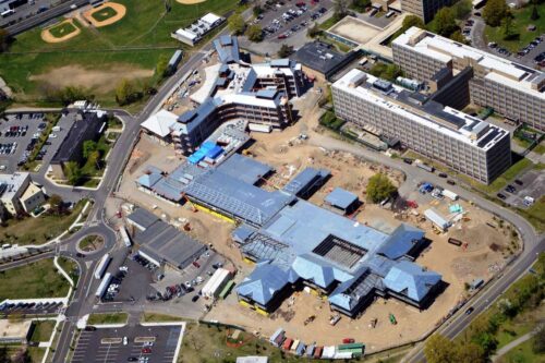
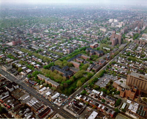
C.T. Male Associates’ GIS Group specializes in project diversity. Our New York State GIS clients include a range of municipal, state and federal government entities, private non-profits, airports, educational institutions, commercial industry and economic development agencies. Our New York State GIS services have been completed for clients located throughout the state, including the Capital Region in areas such as Latham, Albany and Glens Falls as well as Central and Southern NY including Syracuse, Red Hook, Poughkeepsie and more.

GIS Services provided:

  • Infrastructure Data Conversion
  • Facilities Management
  • Needs Assessments
  • Master Planning GIS Support
  • Customized GIS Training
  • GIS Implementation

Our staff expertise includes GIS data development by means of GIS/GPS integration, scanned image digitizing and geodatabase design. Our raster GIS experience extends from distance analysis through viewshed analysis and hydrology (including ArcHydro) to 3D visualization and animation. For our municipal clients, we have completed a number of needs assessments and GIS implementations.

Our project experience includes:

  • GIS Needs Assessments
  • GIS Implementation, Technical Support and Training
  • GIS Distance Analysis
  • Empire Zone Mapping
  • GIS Facilities Management
  • GIS Zoning Maps
  • Airport GIS
  • Data format conversion
  • GIS based Pavement Management
  • Pipeline Mapping – GIS support to Surveying
  • Land Development GIS support
  • Fire District Mapping
  • 3D Visualization and Viewshed Analysis
  • Master Planning GIS Support

We have a broad range of GIS staff talent, including support from C.T. Male Associates’ Civil, Survey, Environmental, Architectural and Planning sectors.

VIEW BROCHURE CONTACT US
© C.T. Male Associates Engineering, Surveying, Architecture,
Landscape Architecture & Geology, D.P.C. - All rights reserved.
  • facebook
  • linkedin
    • Home
    • |
    • Locations
    • |
    • Contact
    • |
    • Accessibility

50 Century Hill Drive, Latham, NY 12110

(518) 786-7400